Low-end tropical storm force conditions for the coast
PANAMA CITY, Fla. (WJHG/WECP) - Tropical Storm Bertha continues to graze on by the Panhandle this morning about 80mi offshore. A more westerly movement is taking shape and that will keep it off our coast for the rest of the day as it treks toward Louisiana into Wednesday. Right now, as you’re reading this on Tuesday afternoon, is the worst the conditions will get from Bertha.
***High surf and dangerous rip currents will be likely through much of this week with dangerous boating conditions until Thursday where seas come down to 2-3ft.***
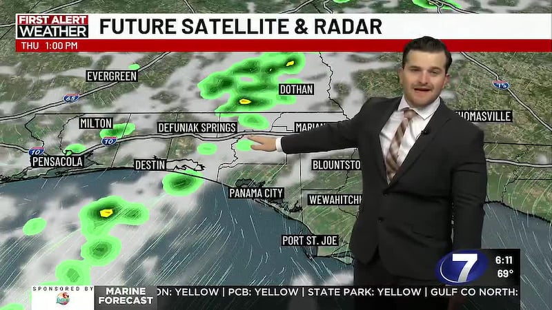
REST OF TODAY: Another day of passing, widely scattered, showers and thunderstorms are likely across the Panhandle this afternoon and into the evening. They’re a bit more persistent today than yesterday in a periodic on and off nature. However, rain totals only fall around a quarter to three quarters of an inch with higher amounts in that range for those who catch a few more than others. Breezier winds from the southeast reach up to 15-20mph with a few higher gusts in passing showers along or north of Hwy20. Expect it to be windier the closer you get to the sandy shores with 20-30mph sustained southeast winds and gusts up to 35-45mph for the coast or low-end tropical storm force gusts.
TONIGHT: Partly cloudy skies with stray and brief showers at a 30-40% chance. Only a tenth or two of rain is expected. Overnight lows reach the upper 70s with slightly breezy southeast to southerly winds at 15-25mph.
MID TO LATE WEEK: The tropical system continues to trek west toward Louisiana and we’re looking at some widely scattered, but fewer and further between, showers or brief storms sticking around for Wednesday. The rain will be hit or miss at a 50% chance. We’ll fall back into a summery pattern of mostly to partly sunny skies Thursday and Friday, lower rain chances of 10-20%, and hotter highs in the low 90s and heat indices back up to near 105-108°.
To stay up to date on all the latest news as it develops, follow WJHG on Facebook, Instagram and X (Twitter).
Have a news tip or see an error that needs correction? Email news@wjhg.com. Please include the article’s headline in your message.
Keep up with all the biggest headlines on the WJHG News app, and check out what’s happening outside using the WJHG Weather app.
Copyright 2026 WJHG. All rights reserved.